Watch live buses
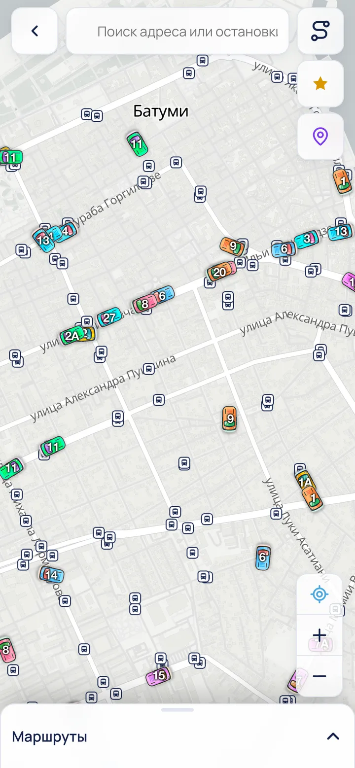
The BatBus map shows every Batumi bus in real time. Open it with “Map” on the home screen, or pick a route number.
 123
123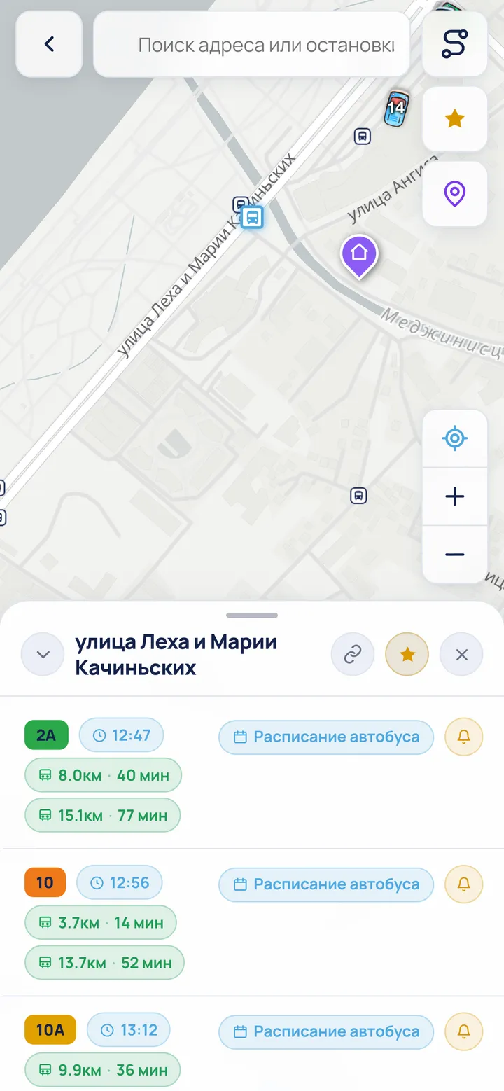 4
4- Buses move on the map live — the coloured badge shows the route number and refreshes every few seconds.
- Dark badges are stops. Tap any stop to open its card.
- The locate button centres the map on you.
- The stop card shows the distance and time to the nearest bus for each route.
- The traffic-light button (it shows up once a route is selected) paints the route line from green to red by how fast buses usually move there at this time of day.
- With a single route selected, the list button shows all its stops by direction — tap a row to open that stop’s card.
- The Routes sheet separates live city buses, municipal minibuses and suburban minibuses. Municipal minibuses are a BatBus Premium feature: without Premium their list is blurred and only the Premium button is active. They have no live GPS; Premium unlocks route lines and planning without live vehicle positions.
- Collapsing the sheet on an empty map hides it completely — the bus button under “−” brings the route list back.
- Arrows on a selected line show the direction of travel. On shared two-way stretches, opposite arrows alternate instead of overlapping.
- The home screen contains all known numbered routes in the same groups; municipal minibus cards also require Premium, while intercity minibuses are listed by destination name.
ℹ At night (23:00–07:00) buses don’t run, so the map will be empty.